Miscellaneous
17,439 items in 132 lists
-
EuclidHL hlplanning.com
An AI assistant with expertise in your city's zoning code and plans. Residents and other civic stakeholders can use EuclidHL to get accurate and timely information about planning and zoning in their community. Technology Division webinar on the topic here.
-
HIFLD hifld-geoplatform.opendata.arcgis.com
This site provides National foundation-level geospatial data within the open public domain that can be useful to support community preparedness, resiliency, research, and more.
-
Hello Lamp Post hellolamppost.co.uk
A proprietary text and SMS-based on-street public engagement tool that uses physical signage and mobile devices to get citizen feedback, improve wayfinding, promote local events and services, or provide creative educational content.
-
National Structures Inventory hec.usace.army.mil
A dataset intended to provide access to consistent, and nationally available point based structure inventories with attribution to support evaluation of consequences from natural and man-made hazards.
-
Heavy.AI heavy.ai
Geotemporal enabled high performance database capable of doing GPU accelerated queries.
-
HealthData.gov healthdata.gov
This site is dedicated to making high value health data in the United States more accessible to entrepreneurs, researchers, and policy makers in the hopes of better health outcomes for all.
-
GOFS gofs.org
The General On-Demand Feed Specification is an open source, community-driven data standard for traveler-facing information about demand responsive transportation.
-
Tile2Net github.com
An end-to-end tool for automated mapping of pedestrian infrastructure from aerial imagery. It provides a deep learning models that semantically segments pedestrian infrastructure from imagery for digitization. It is also available on the Esri Atlas of models.
-
Urban Computing Foundation github.com
Accelerating open source and community development that improves mobility, safety, infrastructure, traffic, and energy consumption in connected cities. Additional Information: Landscape.
-
rasterio github.com
Geographic information systems use GeoTIFF and other formats to organize and store gridded raster datasets such as satellite imagery and terrain models.
-
BLDS github.com
The BLDS data standard is a collaborative effort by civic technology companies, governments and other interested parties to create a shared data specification for building and construction permit data.
-
National Zoning & Land Use Database github.com
This GitHub project catalogs major metros municipal zoning ordinances in plain text. It can be a useful reference for comparing ordinances or perhaps fine tuning language models.
-
Global Human Settlement Layer ghsl.jrc.ec.europa.eu
This global layer of human population is based on remotely sensed land cover classifications and national censuses of population provided by the European Union.
-
OpenPrecincts gerrymander.princeton.edu
A data and software resource to open the redistricting process to all citizens and ensure that district boundaries are fair for all voters.
-
Geospatial Conservation Atlas geospatial.tnc.org
The Nature Conservancy's geospatial portal includes web maps, apps, a map gallery, local initiative portals, conservation data, and other resources.
-
Geopandas geopandas.org
An open source project to make working with geospatial data in Python easier. GeoPandas extends the datatypes used by Pandas to allow spatial operations on geometric types.
-
Geomate geomate.ca
Provides HD vector maps from high-resolution aerial imagery to support autonomous vehicles and urban planning use cases.
-
Global Urban Street Networks geoffboeing.com
Ready‐to‐use global street network models and calculated indicators in a GIS format. Additional Information: Geopackage Download
-
GeoCivix geocivix.com
A user friendly citizen access, plan review, permit, and inspection solution built to drive efficiency, organization, and communication.
-
National Wetland Inventory fws.gov
The US Fish & Wildlife Service (FWS) National Wetlands Inventory (NWI) is a publicly available resource that provides detailed information on the abundance, characteristics, and distribution of US wetlands.
-
flowmap-blue flowmap.blue
Create geographic flow maps representing your data published in Google Sheets. Visualize numbers of movements between locations (origin-destination data).
-
APA Florida Exam Prep Webpage florida.planning.org
Comprehensive collection of study materials compiled by APA Florida. APA members can also email Henry Bittaker at the address given for access to recordings of exam prep and practice question study sessions led by him.
-
RiskFactor firststreet.org
Provided by the First Street Foundation, this tool enables users to understand properties' environmental risks from flooding, wildfire and extreme heat. The tool communicates historic events, current risks, and future projections for properties based on peer-reviewed research…
-
HPMS fhwa.dot.gov
The HPMS is a national level highway information system that includes data on the extent, condition, performance, use and operating characteristics of the nation's highways.
-
FHFA Public Data fhfa.gov
The Federal Housing Finance Agency provides a series of public datasets regarding housing and mortgages in the United States. It including all states, about activity in the U.S. mortgage market through its House Price Index, Refinance Report, Foreclosure Prevention Report…
-
National Risk Index fema.gov
The National Risk Index is an online mapping application from FEMA that identifies communities most at risk to 18 natural hazards.
-
HAZUS fema.gov
FEMA's Hazus Program provides standardized tools and data for estimating risk from earthquakes, floods, tsunamis, and hurricanes. Risk assessment resources and tools from the Hazus program are always freely available and transparently developed.
-
NatureServe Explorer explorer.natureserve.org
NatureServe is the definitive online guide for information on over 100,000 rare and endangered species and ecosystems in the Americas.
-
USDOT Equitable Transportation Community Explorer experience.arcgis.com
The U.S. DOT Equitable Transportation Community (ETC) Explorer is an interactive web application that uses 2020 Census Tracts and data, to explore the cumulative burden communities experience, as a result of underinvestment in transportation, in the following five components…
-
Esri's Python For Everyone esri.com
This course provides the building blocks you need to use Python. You will create and run scripts using these building blocks, and you can apply them directly inside ArcGIS and to your own workflows.
-
GeoComment esri.com
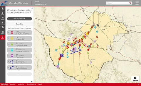
Allows the City staff, citizens and stakeholders of governance to interact digitally and offer meaningful inputs into the decision-making processes at all stages of project development through a map enabled platform.
-
Esri Tapestry Segmentation esri.com
Provides concise information on the demographic, economic, education and consumer characteristics of populations based on ZIP code.
-
ArcGIS Urban esri.com
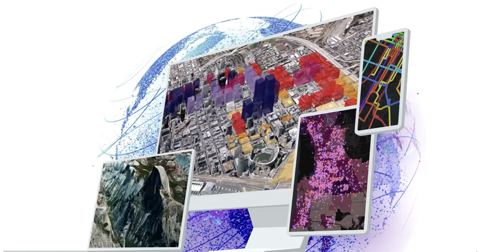
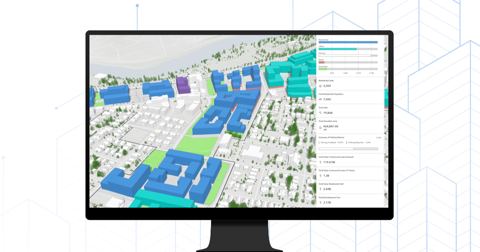
Enables planners and design professionals to publish living plans and collaborate across teams with a web-based 3D application that supports scenario planning and impact assessment.
-
CityEngine esri.com
Advanced 3D modeling software for creating huge, interactive and immersive urban environments in less time than traditional modeling techniques. The cities you create using CityEngine can be based on real-world GIS data and the procedural rules that can help quickly create…
-
ArcGIS esri.com
This platform is a geographic information system (GIS) for working with maps and geographic information maintained by the Environmental Systems Research Institute (ESRI).
-
OpenTwins ertis-research.github.io
An open source platform designed to facilitate the development of digital twins and is characterized by the exclusive use of open source components.
-
Heat and Health Tracker ephtracking.cdc.gov
A resource that presents localized information on public health impacts of extreme heat that can help to better allocate resources to prepare for heat events. The tool includes heat burden data (historic heat-related illness, heat-related emergency department visits, and…
-
EPA WARM Model epa.gov
EPA created the Waste Reduction Model (WARM) to provide high-level estimates of potential greenhouse gas (GHG) emissions reductions, energy savings, and economic impacts from several different waste management practices.
-
Smart Location Database epa.gov
The Smart Location Database is a nationwide geographic data resource for measuring location efficiency. It includes more than 90 attributes summarizing characteristics such as housing density, diversity of land use, neighborhood design, destination accessibility, transit…
-
EnviroAtlas epa.gov
Is a collection of interactive tools and resources that allows users to explore the many benefits people receive from nature, often referred to as ecosystem services within the United States.
-
EPA Data Standards epa.gov
A chart with links to the diversity of data standards adopted by EPA.
-
Enscape enscape3d.com
An easy-to-use rendering software that produces quick, realistic and customizable rendering images for urban design and architectural visualization. The tool integrates well with commonly used 3D modeling softwares such as Rhino, SketchUp, etc.
-
NJTPA Engage engage.njtpa.org
Database of 300 + public engagement tools, techniques, and software. Searchable on multiple levels.
-
Low-Income Energy Affordability Data (LEAD) energy.gov
A free online tool by the U.S. Department of Energy. This interactive platform helps users make data-driven decisions on energy goals and program planning by improving their understanding of low-income and moderate-income household energy characteristics.
-
ENCORE encore.naturalcapital.finance
United Nations sponsored resource intended to explore dependencies on and impacts to our worlds stores of natural capital.
-
Encode Plus encodeplus.com
Software to help modernize planning and zoning ordinances and streamline county or municipal code and by-law management.
-
Temperate element84.com
This user-friendly tool was developed by Azavea in partnership with ICLEI USA, with the primary purpose of facilitating a data-informed adaptation planning process in small-to-midsize communities with little to no devoted resources to plan for climate change impacts.
-
MIT Election Lab electionlab.mit.edu
Election Lab is a clearinghouse for data sets that can fuel studies on elections and how they're conducted. Find election data and research tools produced by us and others.
-
Ecopia ecopiatech.com
Leverages AI to convert high resolution images of the earth into HD Vector Maps and to digitize infrastructure assets in a geospatial format.
-
EcoCounter eco-counter.com
Since 1997, Eco-Counter has developed unique and innovative solutions to count pedestrians and cyclists that vary infrared sensors to computer vision based counters.
- next page of items loading…