Programming
Software development: programming languages, coding, libraries and frameworks, software engineering and architecture, source control, developer tools, databases, and infrastructure.
-
Girls In Tech girlsintech.org
GIT is a global nonprofit focused on the engagement, education and empowerment of girls and women who are passionate about technology. Our aim is to accelerate the growth of innovative women who are entering into the high-tech industry and building successful startups.
-
Girls4Tech girls4tech.ebanx.com
Loc: - Lang: PT-BR only Girls 4 Tech is an online programming course, totally free and made by women. The language is accessible, does not require previous knowledge and is open for everyone.
-
Girls Can Code gcc.prologin.org
Loc: The Girls Can Code is an internship that takes place in 3 different cities and is the perfect opportunity to meet other girls motivated by the programming and to progress together, each at its own pace. The internship will include programming exercises and some lectures…
-
Czechitas czechitas.cz
Loc: Czechitas is a nonprofit organization based in the Czech Republic which organizes events, courses, and summer camps to help women, girls and children to explore the world of IT. The events cover topics from programming, web development, graphic design, digital marketing…
-
KDE Women community.kde.org
KDE Women is a group of women in the KDE community. We are here to help increase the number of women in Open Source and to support each other.
-
Code Girls codegirls.de
Loc: - Lang: Deutsch Only An enthusiastic group of ladies with a focus on web-technologies who want to learn to code, need support in coding, or simply want to understand how the web is made. They meet regularly every two weeks. Everyone is welcome.
-
Code First Girl codefirstgirls.org.uk
Loc: Code First Girl runs free part-time coding courses for young women across the UK, from St Andrews to Southampton. Most courses are run as University chapters, with graduate courses run in London.
-
ClojureBridge clojurebridge.org
ClojureBridge aims to increase diversity within the Clojure community by offering free, beginner-friendly Clojure programming workshops for women.
-
AspireIT aspirations.org
AspireIT is a National Center for Women and Information Technology education program and network for K-12 girls. The program connects nearly 700 programming and computer science organizations in schools in 45 US states, DC, the US Virgin Islands and Puerto Rico. AspireIT also…
-
App Camp 4 Girls appcamp4girls.com
App Camp For Girls is a place where girls can put their creative powers to work by designing and building apps, while learning more about the business of software and being inspired by women mentors in the field.
-
Systers anitab.org
A community of Anita Borg Institute members. It provides a space to discuss and contribute towards Open Source projects, participate in events and discuss any aspect of technology.
-
Ada Developers Academy adadevelopersacademy.org
A year-long tuition-free intensive program for women transitioning into software development. One of the most comprehensive developer training programs available: seven months of full-time classroom instruction plus five months of on-the-ground training (similar to an…
-
AdaCamp Toolkit adacamp.org
Ada Camp used to be a popular conference dedicated to increasing women’s participation in open technology and culture, but it's no longer run. However, they have released all their guides and resources in the form the open source AdaCamp Toolkit for those who want to organize…
-
Open source engineering software appropedia.org
-
Contact Congress (Open Source) github.com
-
Coding Dojo's KataCatalogue codingdojo.org
-
CodeCrafters(Build your own Git, Redis, Docker etc.) app.codecrafters.io
-
WUDAPT wudapt.org
This database intends to make accessible coherent and consistent descriptions and information on form and function of urban morphology relevant to climate & environment studies on a worldwide basis.
-
tidycensus walker-data.com
A tidy approach to accessing data from the US Census Bureau API for manipulation or spatial analysis.
-
U+037E codepoints.net
GREEK QUESTION MARK - a look-alike to the semicolon. Also a fun way to annoy developers.
-
NLCD usgs.gov
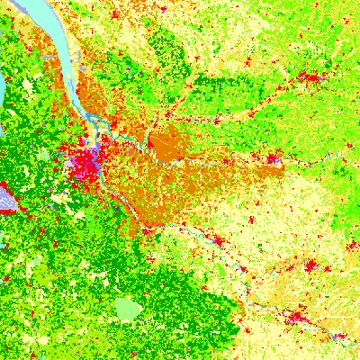
The National Land Cover Database is generated in cooperation with the Multi-Resolution Land Characteristics Consortium (MRLC), a partnership of Federal agencies working together to produce current, nationally consistent, land cover products for all 50 US states and Puerto Rico.
-
TwinMotion twinmotion.com
An easy to use real-time visualization software that creates offline renderer-quality images, animations, and panoramas, together with interactive 360° videos and VR presentations built on Unreal Engine.
-
National Transit Database transit.dot.gov
Repository of operations, financial, and asset data that US transit agencies are required to report to the Federal Transit Administration.
-
TestFit testfit.io
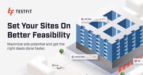
Features algorithms and co-creation tools help developers, architects, urban planners and more to solve hotel, parking or multifamily building site plans in seconds.
-
Tune Studio studio.tune.app
Playground for software developers to finetune and deploy large language models.
-
Spectracities spectracities.com
Spectra is an open source VR and mixed reality platform that allows planners and designers to combine physical placemaking and digital worldbuilding to reimagine the city making process, from single projects and infill development to large-scale immersive environments.
-
Space Syntax spacesyntax.net
Spatial & Network Analysis software is available to professional practitioners and academic researchers for commercial and non-commercial use.
-
SketchUp sketchup.com
Easy to use interactive 3D modeling software for planning and design applications. Supported by a rich asset library for creating neighborhood designs.
-
Rhino rhino3d.com
This is a commercial 3D computer graphics and computer-aided design application software. Rhino has had multiple plug-ins built on top of it including Grasshopper and the Urban Network Analysis toolbox to enable complex modeling and analysis.
-
Geoplot residentmario.github.io
A high-level Python geospatial plotting library. It is an extension to cartopy and Matplotlib which makes mapping easy: like Seaborn for geospatial.
-
PySAL pysal.org
The Python Spatial Analysis Library is a collection of algorithms for exploring spatial correlations and other spatial relationships.
-
TerraVide pypi.org
An open source Python package to process large urban environments mapped with LiDAR (Light Detection and Ranging) data. As of v0.1.6, focuses on tree extraction.
-
Arcpy pro.arcgis.com
A Python site package that provides a useful and productive way to perform geographic data analysis, data conversion, data management, and map automation with Python.
-
National Housing Preservation Database preservationdatabase.org
The National Housing Preservation Database contains property and subsidy-level data pulled from nine different HUD and USDA data sources. The database contains information on over 70,000 properties nationwide.
-
AI Planning Use Cases planning.org
Is an interactive database with a map view that explores real-life applications of AI-powered technology in different planning areas across the US and globally provided by APA's Foresight group.
-
Partridge partridge.readthedocs.io
A Python 3.6+ library for working with GTFS feeds using Pandas DataFrames.
-
NVIDIA Omniverse nvidia.com
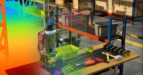
Omniverse is a platform of APIs, SDKs, and services that enable developers to easily integrate Universal Scene Description (OpenUSD) and NVIDIA RTX rendering technologies into existing software tools and simulation workflows.
-
NREL Solar Radiation nsrdb.nrel.gov
The National Solar Radiation Database (NSRDB) is a serially complete collection of hourly and half-hourly values of meteorological data and the three most common measurements of solar radiation: global horizontal, direct normal and diffuse horizontal irradiance.
-
Notion notion.com
A modular, all‑in‑one workspace that unifies note‑taking, documents, databases, and project views that can be used to create shared administrative resources and simple sites quickly by teams and individuals as shown in a Technology Division webinar.
-
National Geologic Map Database ngmdb.usgs.gov
This is a nation wide geologic map database developed by USGS's National Geologic Map Database (NGMDB) that comes with thousands of georeferenced geologic maps searchable through map interaction. Maps are visible at the zoom level that they were originally mapped.
-
NOAA Severe Weather Inventory ncei.noaa.gov
The Severe Weather Data Inventory (SWDI) is an integrated database of severe weather records for the United States. The formats currently supported are Shapefile (for GIS), KMZ (for Google Earth), CSV (comma-separated), and XML.
-
Corine Land Cover land.copernicus.eu
European Land Cover Database generated by the Land Monitoring Core Service (LMCS) of Copernicus, the European flagship programme on Earth Observation.
-
Rapid Transit Database itdp.org
Collection of all rapid transit corridors worldwide, including bus rapid transit, light rail, and subway, published by the Institute for Transportation & Development Policy.
-
Heavy.AI heavy.ai
Geotemporal enabled high performance database capable of doing GPU accelerated queries.
-
GOFS gofs.org
The General On-Demand Feed Specification is an open source, community-driven data standard for traveler-facing information about demand responsive transportation.
-
Urban Computing Foundation github.com
Accelerating open source and community development that improves mobility, safety, infrastructure, traffic, and energy consumption in connected cities. Additional Information: Landscape.
-
National Zoning & Land Use Database github.com
This GitHub project catalogs major metros municipal zoning ordinances in plain text. It can be a useful reference for comparing ordinances or perhaps fine tuning language models.
-
OpenPrecincts gerrymander.princeton.edu
A data and software resource to open the redistricting process to all citizens and ensure that district boundaries are fair for all voters.
-
Geopandas geopandas.org
An open source project to make working with geospatial data in Python easier. GeoPandas extends the datatypes used by Pandas to allow spatial operations on geometric types.
-
Esri's Python For Everyone esri.com
This course provides the building blocks you need to use Python. You will create and run scripts using these building blocks, and you can apply them directly inside ArcGIS and to your own workflows.
- next page of items loading…