Programming
Software development: programming languages, coding, libraries and frameworks, software engineering and architecture, source control, developer tools, databases, and infrastructure.
-
CityEngine esri.com
Advanced 3D modeling software for creating huge, interactive and immersive urban environments in less time than traditional modeling techniques. The cities you create using CityEngine can be based on real-world GIS data and the procedural rules that can help quickly create…
-
OpenTwins ertis-research.github.io
An open source platform designed to facilitate the development of digital twins and is characterized by the exclusive use of open source components.
-
Smart Location Database epa.gov
The Smart Location Database is a nationwide geographic data resource for measuring location efficiency. It includes more than 90 attributes summarizing characteristics such as housing density, diversity of land use, neighborhood design, destination accessibility, transit…
-
Enscape enscape3d.com
An easy-to-use rendering software that produces quick, realistic and customizable rendering images for urban design and architectural visualization. The tool integrates well with commonly used 3D modeling softwares such as Rhino, SketchUp, etc.
-
NJTPA Engage engage.njtpa.org
Database of 300 + public engagement tools, techniques, and software. Searchable on multiple levels.
-
Encode Plus encodeplus.com
Software to help modernize planning and zoning ordinances and streamline county or municipal code and by-law management.
-
Momepy docs.momepy.org
A library for quantitative analysis of urban form - urban morphometrics. It is part of PySAL (Python Spatial Analysis Library) and is built on top of GeoPandas, other PySAL modules and networkX.
-
Digiplan digeplan.com
Provides software for fully integrated electronic plan review and intake processes.
-
Strava developers.strava.com
API for a popular tracking app for runners and cyclists. Data can be used to understand active transportation usage and patterns.
-
Unicode Character Database unicode.org
-
JavaScript has a Unicode Problem mathiasbynens.be
-
The Absolute Minimum Every Software Developer Absolutely, Positively Must Know About Unicode and Character Sets joelonsoftware.com
By Joel Spolsky
-
Database Dumps of Codepoints.net dumps.codepoints.net
-
ArcGIS Python API developers.arcgis.com
The ArcGIS API for Python is a powerful, modern and easy to use Pythonic library to perform GIS visualization and analysis, spatial data management and GIS system administration tasks that can run both interactively, and using scripts. This library enables easy use of Pandas…
-
Data Center Policy Database datacenterpolicy.com
A searchable database of data center policies, useful for planners navigating the land rezoning, water and energy demands, and transparency issues that accompany data center siting in their jurisdictions.
-
PTNA wiki.openstreetmap.org
Public Transit Nework Analysis is a open source system for finding and aggregating information about public transportation lines mapped in OSM.
-
Transport API transportapi.com
REST API for aggregated transit data for the United Kingdom. Fee-based access.
-
Transit Display transitdisplay.com
Multimodal and real-time transit display software.
-
National Transit Database (USA) transit.dot.gov
Information and statistics on the transit systems of the United States, run by the Federal Transit Administration.
-
Mobroute sr.ht
Mobroute is a general purpose FOSS public transportation router (e.g. trip planner) Go library and CLI that works by directly ingesting timetable (GTFS) data from transit agencies themselves (sourced from the Mobility Database). It can be used to quickly run & test routing…
-
MobilityData Slack chat share.mobilitydata.org
Chatroom that includes channels #gtfs, #gtfs-validators #mobility-database #gtfs-realtime #gtfs_best-practices #gtfs-pathways #gtfs-fares #gtfs-flex #trb-transit-data.
-
PTV Lines ptvgroup.com
A cloud-based public transport software for line planning and public transport service optimisation
-
Android play.google.com
(source code), Fire Phone (source code), iOS (source code), Windows Phone (source code), Google Glass GDK (source code), Alexa skill (source code)
-
OneBusAway onebusaway.org
A Java app that consumes GTFS and GTFS-Realtime (along with other formats) and turns them into an easy to use REST API.
-
motis-client npmjs.com
MOTIS API TypeScript client
-
NextBus API nextbus.com
REST API for real-time vehicle, route, stop, and arrival data for agencies that have puchased NextBus's hardware and/or software.
-
Navitia.io navitia.io
REST API for journey planning, stop schedules, isochrones and lot more on US and EU. Navitia is the opensource engine behind the live API.
-
MBTA GTFS Onboarding mybinder.org
An interactive tutorial created by MBTA for GTFS static. A stand-alone Docker image is available on GitHub as well as a hosted/no-install version of the Jupyter notebook.
-
The Mobility Database mobilitydatabase.org
JSON and CSV files on GitHub that is a repository of 2000+ mobility datasets across the world. Contains contents of OpenMobilityData/TransitFeeds.com.
-
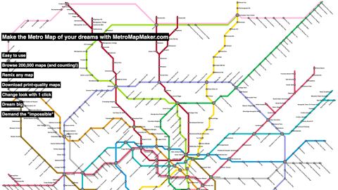
Metro Map Maker metromapmaker.com
An open source and simple metro map maker software.
-
MetroDreamin' metrodreamin.com
A modern, open source software that allows users to create, save, like, and share interactive transit maps with agents.
-
Linked Connections linkedconnections.org
An open-source, scalable intermodal route planning engine, which allows clients to execute the route planning algorithm (as opposed to the server). Uses GTFS data.
-
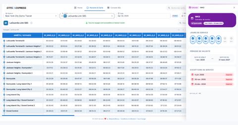
GTFS Express gtfsexpress.com
Web application to edit, validate and analyze GTFS feeds — including Fares v2 and GTFS-Flex — with an interactive schedule grid and map editor, an SQL console with AI-assisted natural-language queries, and strict canonical validation via MobilityData's gtfs-validator.
-
GTFS.guru gtfs.guru
Rust-core GTFS validator that compiles to WebAssembly so feeds can be validated locally in the browser. Also ships desktop apps, a CLI, and Python bindings.
-
OneBusAway Developers mailing list groups.google.com
-
OneBusAway API mailing list groups.google.com
-
TXC TransXChange publisher (UK Department for Transport) gov.uk
The TXC TransXChange publisher is a standalone software tool that can be used to publish TransXChange compliant XML documents in a format that’s easy to read and print.
-
SIRI API github.com
Java classes generated from the v1.0 and v1.3 SIRI schemas.
-
NextBus API to GTFS-realtime github.com
A Java-based command-line utility to convert from the NextBus API format to GTFS-realtime. Note that NextBus now directly offers a GTFS-realtime API for their products. See Cubic site and this FAQ.
-
OneBusAway GTFS Modules github.com
A Java-based library for reading, writing, and transforming public transit data in the GTFS format, including database support.
-
MaaS API github.com
A set of open documents and test suite that defines a MaaS-compatible API.
-
Transitfeed merge function github.com
A Python library with a function to merge two different GTFS feeds.
-
Google's feedValidator github.com
Google-supported Python-based GTFS validator.
-
SIRI REST Client github.com
An open-source Android library for interacting with the RESTful SIRI interface for real-time transit data, such as that currently being used by the MTA Bus Time API.
-
SIRI 1.3 POJOs (Android-compatible) github.com
Android-compatible Plain Old Java Objects (POJOSs) used for data binding (deserliazing XML/JSON) responses for SIRI v1.3 APIs. Used by the SIRI REST Client.
-
kml-to-gtfs-shapes github.com
Javascript tool to convert polylines from a KML file into a GTFS shapes.txt file. Hosted on GitHub here.
-
Transito git.sr.ht
FOSS data-provider-agnostic public transportation app that let's you route between locations using openly available public GTFS feeds (sourced from the Mobility Database). Utilizing the Mobroute Go API, the Transito app lets you performs routing calculations right on your…
-
OSMTransportViewer gileri.github.io
Use OSM Overpass API to get network data
-
RoutePress GTFS to GeoJSON Converter getroutepress.com
Free, easy-to-use browser tool that converts GTFS shapes and stops into GeoJSON for use in ArcGIS, QGIS, and other GIS software. No installation required.
-
Compares software tools for calculating accessibility by walking and public transit including ArcGIS Pro, Emme, R5R, and OpenTripPlanner.
- next page of items loading…