NLCD
The National Land Cover Database is generated in cooperation with the Multi-Resolution Land Characteristics Consortium (MRLC), a partnership of Federal agencies working together to produce current, nationally consistent, land cover products for all 50 US states and Puerto Rico.
- from
- Urban & Regional Planning
- added
- 2026-10-10
- likes
- 0
similar
-
Corine Land Cover land.copernicus.eu
European Land Cover Database generated by the Land Monitoring Core Service (LMCS) of Copernicus, the European flagship programme on Earth Observation.
-
CropScape nassgeodata.gmu.edu
This application displays data from the USDA Cropland Data Layer (CDL), an annual, remote-sensing snapshot of crop cover during the main growing season across the contiguous United States.
-
LBCS planning.org
The American Planning Association's Land Based Classification Standards classifies land uses across five dimensions (Activity, Function, Structure, Site, and Ownership).
-
National Zoning & Land Use Database github.com
This GitHub project catalogs major metros municipal zoning ordinances in plain text. It can be a useful reference for comparing ordinances or perhaps fine tuning language models.
-
National Geologic Map Database ngmdb.usgs.gov
This is a nation wide geologic map database developed by USGS's National Geologic Map Database (NGMDB) that comes with thousands of georeferenced geologic maps searchable through map interaction. Maps are visible at the zoom level that they were originally mapped.
-
LANDSAT Products usgs.gov
Landsat U.S. Analysis Ready Data (ARD) products are consistently processed to the highest scientific standards and level of processing required for direct use in monitoring and assessing landscape change.
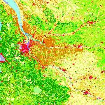
Urban & Regional Planning › Public Data Resources > Land Use and Land Cover: “The National Land Cover Database is generated in cooperation with the Multi-Resolution Land Characteristics Consortium (MRLC), a partnership of Federal agencies working together to produce current, nationally consistent, land cover products for all 50 US states and Puerto Rico.”