-
EnviroAtlas epa.gov
Is a collection of interactive tools and resources that allows users to explore the many benefits people receive from nature, often referred to as ecosystem services within the United States.
-
EPA Data Standards epa.gov
A chart with links to the diversity of data standards adopted by EPA.
-
Enscape enscape3d.com
An easy-to-use rendering software that produces quick, realistic and customizable rendering images for urban design and architectural visualization. The tool integrates well with commonly used 3D modeling softwares such as Rhino, SketchUp, etc.
-
NJTPA Engage engage.njtpa.org
Database of 300 + public engagement tools, techniques, and software. Searchable on multiple levels.
-
Low-Income Energy Affordability Data (LEAD) energy.gov
A free online tool by the U.S. Department of Energy. This interactive platform helps users make data-driven decisions on energy goals and program planning by improving their understanding of low-income and moderate-income household energy characteristics.
-
ENCORE encore.naturalcapital.finance
United Nations sponsored resource intended to explore dependencies on and impacts to our worlds stores of natural capital.
-
Encode Plus encodeplus.com
Software to help modernize planning and zoning ordinances and streamline county or municipal code and by-law management.
-
Temperate element84.com
This user-friendly tool was developed by Azavea in partnership with ICLEI USA, with the primary purpose of facilitating a data-informed adaptation planning process in small-to-midsize communities with little to no devoted resources to plan for climate change impacts.
-
MIT Election Lab electionlab.mit.edu
Election Lab is a clearinghouse for data sets that can fuel studies on elections and how they're conducted. Find election data and research tools produced by us and others.
-
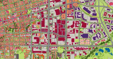
Ecopia ecopiatech.com
Leverages AI to convert high resolution images of the earth into HD Vector Maps and to digitize infrastructure assets in a geospatial format.
-
EcoCounter eco-counter.com
Since 1997, Eco-Counter has developed unique and innovative solutions to count pedestrians and cyclists that vary infrared sensors to computer vision based counters.
-
EarthDefine earthdefine.com
Using AI to transform earth sensor data into consumable geospatial information products including high resolution land cover classifications and building footprints.
-
Extreme Heat Data Pathfinder earthdata.nasa.gov
A central repository hosting multiple datasets guiding users to relevant near-real-time data for extreme heat analysis and visualization based on NASA's remotely sensed data.
-
Mapping Inequality dsl.richmond.edu
An interactive map that layers georectified Home Owners' Loan Corporation (HOLC) maps onto a modern basemap of the United States. These color-coded HOLC maps were a physical embodiment of the real estate practice known as redlining. Additional Information: License: CC BY-NC-SA…
-
Geofabrik download.geofabrik.de
OpenStreetMap extracts prepared in either PBF or shapefile format for download daily.
-
BBBike download.bbbike.org
Provides shapefiles and raw OSM format for cities around the world, extracted weekly. This is useful if you are looking for data extracts for a single city.
-
GATIS dotbts.github.io
A data specification for active transportation infrastructure that is supported by the National Collaboration on Bicycle, Pedestrian, and Accessibility Infrastructure Data (NC-BPAID).
-
vLLM docs.vllm.ai
A high-throughput and memory-efficient inference and serving engine for LLMs.
-
Momepy docs.momepy.org
A library for quantitative analysis of urban form - urban morphometrics. It is part of PySAL (Python Spatial Analysis Library) and is built on top of GeoPandas, other PySAL modules and networkX.
-
ClimRR disgeoportal.egs.anl.gov
This portal empowers individuals, governments, and organizations to examine simulated future climate conditions at mid- and end-of-century for a range of climate perils.
-
Digital.Gov digital.gov
Guidance and resources on building better digital services in government.
-
Digiplan digeplan.com
Provides software for fully integrated electronic plan review and intake processes.
-
Strava developers.strava.com
API for a popular tracking app for runners and cyclists. Data can be used to understand active transportation usage and patterns.
-
GTFS-RT developers.google.com
This standard provides users transit data updates in real time greatly enhances their experience of transit services.
-
http://www.unifont.org/fontguide/ unifont.org
-
Version 4.0.0 unicode.org
-
Version 9.0.0 unicode.org
(Latest Version, August 2016 - adds exactly 7,500 characters)
-
Version 7.0.0 unicode.org
-
Version 6.3.0 unicode.org
-
Version 6.2.0 unicode.org
-
Version 6.1.0 unicode.org
-
Version 6.0.0 unicode.org
-
Version 5.2.0 unicode.org
-
Version 5.1.0 unicode.org
-
Version 4.0.1 unicode.org
-
Unicode Character Database unicode.org
-
http://www.unicode.org/roadmaps/ unicode.org
-
-
Unicode FAQ unicode.org
-
Unicode Consortium's Emoji Chart unicode.org
-
Confusable Unicode Characters unicode.org
-
Unicode Normalization Chart unicode.org
-
Unicode Character Code Charts unicode.org
-
Unicode Case Charts unicode.org
-
Unicode Blocks List unicode.org
-
Space Yourself smashingmagazine.com
Smashing Magazine's Spacing Guide
-
Shapecatcher shapecatcher.com
Draw the character you're looking for.
-
How to register an emoji URL name.com
-
JavaScript has a Unicode Problem mathiasbynens.be
-
Creative usernames and Spotify account hijacking labs.spotify.com
- next page of items loading…