-
-
The Absolute Minimum Every Software Developer Absolutely, Positively Must Know About Unicode and Character Sets joelonsoftware.com
By Joel Spolsky
-
https://en.wikipedia.org/wiki/Unicode_font#List_of_Unicode_fonts en.wikipedia.org
-
emojitracker emojitracker.com
Realtime emoji use on Twitter.
-
Emojipedia emojipedia.org
Information about specific emoji, news blog.
-
World Translation Foundation emojifoundation.com
A way to promote, explore, and translate the written word into the pictorial alphabet of Emoji.
-
Database Dumps of Codepoints.net dumps.codepoints.net
-
Can I Emoji? caniemoji.com
Displays the current status of native Emoji support across iOS, Android and Windows.
-
ArcGIS Python API developers.arcgis.com
The ArcGIS API for Python is a powerful, modern and easy to use Pythonic library to perform GIS visualization and analysis, spatial data management and GIS system administration tasks that can run both interactively, and using scripts. This library enables easy use of Pandas…
-
Urban Heat Disparities Project dataverse.harvard.edu
Census Tract level temperature data derived from a paper use remotely sensed land surface temperature measurements to explore the distribution of the United States urban heating burden by demographic group.
-
Harvard Dataverse dataverse.harvard.edu
A repository for research data. It contains a wide variety of datasets spanning the sciences, many with public domain dedications.
-
Data Standards Directory datastandards.directory
This open directory of data standards aggregates known data standard examples and features a taxonomy on how to understand their application.
-
Data Center Policy Database datacenterpolicy.com
A searchable database of data center policies, useful for planners navigating the land rezoning, water and energy demands, and transparency issues that accompany data center siting in their jurisdictions.
-
GTNS zephyrtransport.org
General Travel Network Specification: A planned data specification for sharing travel demand model networks.
-
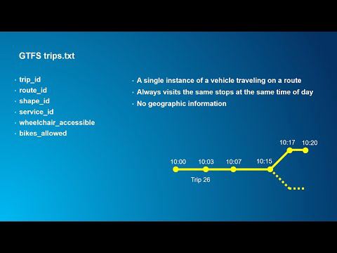
MobilityData - "Understanding GTFS: An intro and overview" youtube.com
Video provides an overview of of the General Transit Feed Specification (GTFS) and why it is useful for transit agencies, riders, and policymakers.
-
ArcGIS - Introduction to GTFS youtube.com
-
YourStop yourstop.info
Mobile friendly web app which consumes GTFS feeds and displays both live and scheduled trips for stops. Launched with MBTA, YRT/Viva and Maryland MTA.
-
Yandex Maps - Transport integration yandex.ru
Additional Yandex-specific documentation of GTFS.
-
Rail Transit Maps www-personal.umich.edu
A collection of railway maps covering Europe (especially Russia).
-
Rail Map Generators wongchito.github.io
Tool for generating railway maps and information panels in the styles of various cities' public transportation systems.
-
WMATA Exit Optimizer wmata-exit-optimizer.com
Suggests which train car to board for the shortest walk to your destination station's exit on the WMATA Metro.
-
OSM Relatify wiki.openstreetmap.org
OSM Relatify is a tool that simplifies the process of maintaining public transport relations.
-
PTNA wiki.openstreetmap.org
Public Transit Nework Analysis is a open source system for finding and aggregating information about public transportation lines mapped in OSM.
-
OsmAnd wiki.openstreetmap.org
OsmAnd is a GPS Navigation and map application that runs on many Android and iOS smartphones and tablets, featuring optional offline maps and turn by...
-
Openptmap wiki.openstreetmap.org
openptmap shows public transport lines.
-
OpenStop wiki.openstreetmap.org
OpenStop is a free app to add information about barriers and other accessibility properties of public transport stops to OpenStreetMap.
-
OSMTracker wiki.openstreetmap.org
OSMTracker is an offline GPS tracking app designed for collecting Points of Interest (POIs) and recording GPX tracks for collaborative use.
-
JOSM Plugins - PT Assistant wiki.openstreetmap.org
The plugin validates public transport routes against a set of criteria and, where possible, suggests ways to fix them.
-
AccraMobile3 wiki.openstreetmap.org
Accra Mobile 3 is a project launched in July 2017 to map all the Tro tro lines of Accra, Ghana for the Department of Transport (DoT) of Accra...
-
UrbanRail.Net urbanrail.net
Worldwide reference map of urban rail transport (metros,trams,commuter rail) with detailed and up-to-date information.
-
Ualabee ualabee.com
Community driven trip planner with focus on user interaction, users can report anomalies, upload pictures, edit transit data and chat with other passengers.
-
MTA Frequency tyleragreen.com
Frequency visualization of subways and buses in New York City built using Transitland.
-
TripGo tripgo.com
-
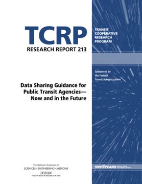
TCRP Research Report 213: Data Sharing Guidance for Public Transit Agencies – Now and in the Future trb.org
(2020) - A report designed to help agencies make decisions about sharing their data, including how to evaluate benefits, costs, and risks.
-
Traze traze.app
by Veridict - Visualization of public transport vehicles from all over the world. Collaborate with other users to get real-time updates even when it is not available from the agency. Based on a number of sources, including GTFS and GTFS-RT. (Previously known as Livemap24).
-
TransSee transsee.ca
Real-time transit predictions based on actual travel times, vehicle locations, schedules and maps. Premium gives you access to a detailed history of schedules, vehicle locations, stop arrivals, schedule adherance, charts and graphs. For an additional fee custom queries can be…
-
Transport API transportapi.com
REST API for aggregated transit data for the United Kingdom. Fee-based access.
-
GTFS Diff transport.data.gouv.fr
GTFS Diff is a specification created by transport.data.gouv.fr and aims at providing a simple and unified way to express differences between GTFS files.
-
transport.data.gouv (France) transport.data.gouv.fr
Data platform for the French transport ecosystem.
-
Transit Tracker transittracker.ca
Realtime vehicle position for Greater Montreal & Toronto, Canada
-
Transit Techies NYC transittechies.nyc
NYC-based in-person/online hybrid meetup. Speaker list includes many contributors to this repo.
-
TransitScreen transitscreen.com
Custom realtime displays of all local transportation choices
-
Transitous transitous.org
Community-run free and open public transport routing service.
-
Transit Maps transitmap.net
Critiques and reviews of the design of transit maps from across the world.
-
Transit Display transitdisplay.com
Multimodal and real-time transit display software.
-
Open Transit Data Toolkit transitdatatoolkit.com
A series of lessons to help people utilize open transit data.
-
"AVL, CAD, and Real-Time Passenger Info for Beginners" by Tony Laidig transitdata.net
Provides a general introduction to technology used to track vehicles.
-
TransitData.io transitdata.io
A list of GTFS data in parts of Latin America. Must contact website maintainers directly to access feeds, as they're not publicly available.
-
Transit transitapp.com
-
TransitLand Map transit.land
Worldwide map of transit services (which have a GTFS Feed).
- next page of items loading…