Miscellaneous
17,439 items in 132 lists
-
Who did it? simon04.dev.openstreetmap.org
Map highlighting recent edits per tile. Provides RSS feeds for watching changes in custom bounding boxes. (Source Code / Wiki)
-
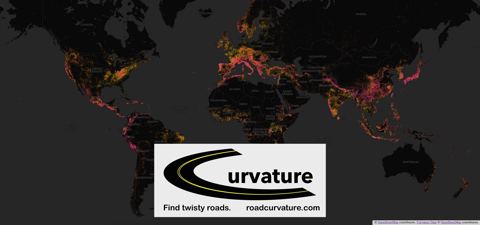
Road Curvature roadcurvature.com
Helps to find curvy roads for those who enjoy them. (Source Code)
-
Suspicious OSM Changesets resultmaps.neis-one.org
Find suspicious OSM changesets.
-
Latest Changeset Discussions resultmaps.neis-one.org
Show latest discussions on OSM changesets.
-
Changeset Text Search resultmaps.neis-one.org
Filter OSM changesets by comment.
-
Osm Change Viz resultmaps.neis-one.org
Changeset visualizer displaying information about added/modified/deleted elements in different panels.
-
Osm Change Tiles resultmaps.neis-one.org
Map highlighting recent edits per tile. Provides RSS feeds for watching changes in custom bounding boxes.
-
latest-changes rene78.github.io
Visualize latest OSM changesets within a certain geographic boundary. Includes a simple vandalism checker. (Source Code)
-
r/openstreetmap reddit.com
Inofficial Reddit forum dedicated to sharing OSM related links and news.
-
Rapid rapideditor.org
AI assisted versions of iD. (Meta-Repo / Editor Source Code / Wiki)
-
QLever qlever.dev
SPARQL API for OSM data. (Wiki)
-
YoHours projets.pavie.info
Tool for generating opening_hours tags. (Source Code)
-
MyOSMatic print.get-map.org
Website for generating printable street maps from OSM data. (Source Code)
-
planet.osm planet.osm.org
Minutely/weekly/yearly/full dumps of osm data. (Wiki)
-
OSM Statistics piebro.github.io
Up-to-date OSM statistics about editor usage, corporate contributions and more.
-
Pic4Review pic4review.pavie.info
Tool for adding objects to OSM by reviewing images. (Source Code / Wiki)
-
PanoramaxGuessr panoramaxguessr.k327.eu
A geography game that serves as a FOSS alternative to GeoGuessr, using Panoramax imagery for location identification. (Source Code)
-
PanoGuessr panoguessr.com
A geography game that uses Panoramax to challenge players in identifying locations worldwide from Panoramax images. (Source Code)
-
Ultra overpass-ultra.us
Web based tool for making maps with a variety of data APIs such as overpass, postpass, qlever, ohsome, sophox, and more. (Source Code)
-
achavi overpass-api.de
Augmented change viewer. (Source Code / Wiki)
-
overpass overpass-api.de
Read-only API that serves up custom selected parts of the OSM map data. (Source Code / Wiki)
-
OSMyBiz osmybiz.osm.ch
Website for managing informations about your business. (Source Code / Wiki)
-
Osmose osmose.openstreetmap.fr
QA-tool for fixing problems detected in OpenStreetMap data. (Source Code / Wiki)
-
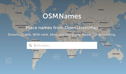
OSMNames osmnames.org
Geocoding tool ranking places according to the corresponding Wikipedia page popularity. (Source Code / Wiki)
-
OSM Landuse osmlanduse.org
OSM based landuse and landcover WebGIS application.
-
Show me the way osmlab.github.io
Live map showing latest changes on aerial imagery. (Source Code / Wiki)
-
changeset-map osmlab.github.io
Map visualizing changes in selected changesets. Used in OsmCha. (Source Code)
-
OSM History Viewer osmhv.openstreetmap.de
Changeset visualization. (Source Code)
-
OSM Go! osmgo.com
Android application and a Progressive Web Applications (PWA) for contributing to OpenStreetMap. (Android / Source Code / Wiki)
-
OSMCha API osmcha.org
Powerful API that allows to query and retrieve changeset information. (Source Code)
-
osmcha osmcha.org
Detector for suspicious changesets. (Source Code / Wiki)
-
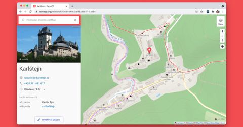
OsmAPP osmapp.org
A browsable map showing data and offering simple POI-editing capabilities. (Source Code)
-
OsmAnd osmand.net
Map viewing and navigation (routing) application with offline functionality available for Android and iOS. (Android, iOS / Source Code Android / Source Code iOS / Wiki)
-
OSM2World osm2world.org
converter that creates three-dimensional models of the world from OpenStreetMap data. It can be used as a stand-alone tool, on a server or as a library in Java programs. (Source Code / Wiki)
-
osm.mazdermind osm.mazdermind.de
Maps Timestamp to replicate sequences. (Source Code)
-
Bellingcat OpenStreetMap search osm-search.bellingcat.com
Web based tool to find geolocation leads by searching for proximate features on OpenStreetMap. (Source Code / Article)
-
OSM Monitor osm-monitor.com
A website to monitor and display new OSM edits. (Source Code)
-
OSM In Realtime osm-in-realtime.jwestman.net
Visualization of the changes made to OpenStreetMap as they happen. (Source Code / Wiki)
-
Organic Maps organicmaps.app
A free offline maps app based on OSM. (Android, iOS / Source Code / Wiki)
-
iD openstreetmap.org
JavaScript based editor for the web browser with a wide array of presets. (Source Code / Wiki)
-
OpenLevelUp! openlevelup.net
An OSM based indoor viewer.(Wiki)
-
opening_hours evaluation tool openingh.openstreetmap.de
Tool for evaluating opening_hours tags. (Source Code)
-
OpenGeofiction opengeofiction.net
A completely fictional user-made world map, created using the OSM software platform. (Wiki)
-
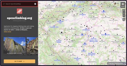
openclimbing.org openclimbing.org
A map for rock climbers with editor for creating interactive climbing guides based on OpenStreetMap.
-
OnOSM onosm.org
Allows anyone to submit business information as a note for inclusion into OSM. (Source Code / Wiki)
-
ohsome Dashboard ohsome.org
Tool for visualizing changes over a certain time period. (Wiki)
-
Nominatim QA nominatim.org
The Nominatim Data Analyser is a QA tool used to scan the nominatim database and extract suspect data from it. These data are then presented to mappers through a visual interface so that they can correct them directly.
-
NLMaps nlmaps.gorgor.de
Website allowing to query OSM data using plain English.
-
My Notes my-notes.osm-hr.org
Search for finding your old unresolved notes.
-
MapPoster Online maptoposter.0v0.one
Web-based map poster generator with customizable styles. (Source Code)
- next page of items loading…