Miscellaneous
17,439 items in 132 lists
-
LBCS planning.org
The American Planning Association's Land Based Classification Standards classifies land uses across five dimensions (Activity, Function, Structure, Site, and Ownership).
-
APA Knowledge Base planning.org
APA's Research KnowledgeBase connects APA members to curated collections of topically related resources — including plans, regulations, model codes, guides, articles, reports, and multimedia files. Each collection provides commentary and thematic groupings of resource records…
-
AI Planning Use Cases planning.org
Is an interactive database with a map view that explores real-life applications of AI-powered technology in different planning areas across the US and globally provided by APA's Foresight group.
-
AICP Exam Prep. Webpage planning.org
Details the AICP's "Five-Step Approach" for exam preparation and lists resources/materials to help you succeed on the AICP exam.
-
AICP Get Certified! Webpage planning.org
The American Institute of Certified Planners's (AICP) offical resource repository that provides details on eligibility, registration, and preparation. Important dates for upcoming AICP "Certification Cycles" are also listed.
-
Planopedia planetizen.com
Organized by the Planning News aggregator Planetizen this mini-planning encyclopedia explores various urban planning concepts and terms.
-
Civic Tech Field Guide planetizen.com
Similar to this repo, a collection of resources of the Civic Tech Field Guide have been crowdsourced by civic tech practitioners from over 100 countries around the world.
-
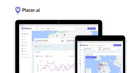
PlacerAI placer.ai
A location based data provider that provides estimates of foottraffic to different points of interest.
-
Partridge partridge.readthedocs.io
A Python 3.6+ library for working with GTFS feeds using Pandas DataFrames.
-
Overture Maps overturemaps.org
A joint mapping consortium looking to power current and next-generation map products by creating reliable, easy-to-use, and interoperable open map data. Builds on OpenStreetMap and other datasets to expand access to open data.
-
Opportunity Atlas opportunityatlas.org
These datasets provided by Opportunity Insights allow you to analyze social mobility and a variety of other outcomes from life expectancy to patent rates by neighborhood, college, parental income level, and racial background.
-
OpenGov opengov.com
Cloud solution to power every permit, license, and inspection with user-friendly workflows.
-
CityGML ogc.org
The CityGML standard defines a conceptual model and exchange format for the representation, storage and exchange of virtual 3D city models. It enables an interdisciplinary common operating platform for civic systems.
-
OECD AI Policy Observatory oecd.ai
Provides a platform for resources on applications, poicy implications, and literature regarding Artificial Intelligence.
-
NVIDIA Omniverse nvidia.com
Omniverse is a platform of APIs, SDKs, and services that enable developers to easily integrate Universal Scene Description (OpenUSD) and NVIDIA RTX rendering technologies into existing software tools and simulation workflows.
-
Numina numina.co
Utilizes edge computing devices that measures all kinds of curb-level activity. Anonymously and in aggregate, Numina delivers the volume counts, paths, and traffic behaviors of travelers and objects in streets.
-
NREL Solar Radiation nsrdb.nrel.gov
The National Solar Radiation Database (NSRDB) is a serially complete collection of hourly and half-hourly values of meteorological data and the three most common measurements of solar radiation: global horizontal, direct normal and diffuse horizontal irradiance.
-
OpenPath nrel.gov
Continuous travel survey platform from NREL that collects trips and data via a smart phone app backed by a server and leveraging automated data processing.
-
National Register of Historic Places nps.gov
The National Register of Historic Places is the official list of the Nation's historic places worthy of preservation.
-
Notion notion.com
A modular, all‑in‑one workspace that unifies note‑taking, documents, databases, and project views that can be used to create shared administrative resources and simple sites quickly by teams and individuals as shown in a Technology Division webinar.
-
IPUMS National Historic GIS nhgis.org
The National Historical Geographic Information System (NHGIS) provides easy access to summary tables and time series of population, housing, agriculture, and economic data, along with GIS-compatible boundary files, for years from 1790 through the present and for all levels of…
-
National Geologic Map Database ngmdb.usgs.gov
This is a nation wide geologic map database developed by USGS's National Geologic Map Database (NGMDB) that comes with thousands of georeferenced geologic maps searchable through map interaction. Maps are visible at the zoom level that they were originally mapped.
-
Earthquake Data ngdc.noaa.gov
NOAA provided data includes a global record of significant earthquakes going back to 2150 BC to the present with geographic information.
-
Education Demographics & Geographic Estimates (EDGE) nces.ed.gov
EDGE provides access to demographic and school related geographic data such as locations and districts.
-
National Center for Educational Statistics nces.ed.gov
The National Center for Education Statistics (NCES) is the primary federal entity for collecting and analyzing data related to education. Their data lab provides access to other 30+ education datasets and provides quick reporting and charting functionality for users.
-
NOAA Severe Weather Inventory ncei.noaa.gov
The Severe Weather Data Inventory (SWDI) is an integrated database of severe weather records for the United States. The formats currently supported are Shapefile (for GIS), KMZ (for Google Earth), CSV (comma-separated), and XML.
-
NCDC Storm Data ncei.noaa.gov
United States storm data provided by the National Weather Service (NWS) and contain statistics on personal injuries and damage estimates.
-
NCCS Data Services nccs.nasa.gov
The NASA Center for Climate Simulation houses curated data collections that include atmosphere, ocean, land, and flood data, both current and historical, as well as operational Global Modeling and Assimilation Office (GMAO) weather analysis data and forecasts that are updated…
-
CropScape nassgeodata.gmu.edu
This application displays data from the USDA Cropland Data Layer (CDL), an annual, remote-sensing snapshot of crop cover during the main growing season across the contiguous United States.
-
MyGovernmentOnline mygovernmentonline.org
Digital government solutions for permitting and in-office processes designed by government for government (provider is technically a public agency).
-
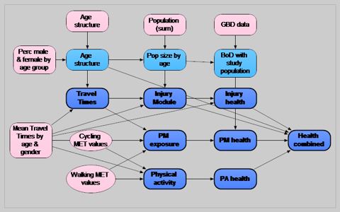
ITHIM mrc-epid.cam.ac.uk
Integrated Transport and Health Impact Model (ITHIM) refers to a range of related models and tools developed to perform integrated assessment of the health effects of transport scenarios and policies at the urban and national level. This page points to different literature, R…
-
Metroquest metroquest.com
Comprehensive community engagement platform, providing surveys, games, and interactive maps to engage the public around planning issues.
-
Maptionnaire maptionnaire.com
Provides map-based tools for designing questionnaires, collecting survey data, and conveying information.
-
State and Local Planning for Energy (SLOPE) Platform maps.nrel.gov
A free easy-to-access online platform, by the U.S. Department of Energy, to support data-driven state and local energy and decarbonization planning. SLOPE includes two distinct tools namely the Scenario Planner and the Data Viewer to support jurisdictions planning needs.
-
Mapillary mapillary.com
Access street-level imagery and AI-derived map data from all over the world. Fill in the gaps by requesting new coverage or capturing your own with an easy to use mobile app.
-
Extreme Heat Dashboard liheap-and-extreme-heat-hhs-acf.hub.arcgis.com
This dashboard, developed by the U.S. Department of Health and Human Services Low Income Home Energy Assistance Program (LIHEAP) can help planners understand extreme heat and energy needs and impacts to vulnerable communities.
-
Longitudinal Employer-Household Dynamics (LEHD) lehd.ces.census.gov
The LEHD program combines administrative data, and data from censuses and surveys. From these data, the program creates statistics on employment, earnings, and job flows at detailed levels of geography and industry and for different demographic groups. Additional Information…
-
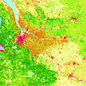
Corine Land Cover land.copernicus.eu
European Land Cover Database generated by the Land Monitoring Core Service (LMCS) of Copernicus, the European flagship programme on Earth Observation.
-
Jupiter Intelligence jupiterintel.com
Provides global high resolution climate projections out to 2100 for a variety of hazards (flood, precipitation, wind, heat/cold, wildfire, thunderstorms, drought) as well as asset-level estimates of damage and financial loss.
-
iTree itreetools.org
Quantifies the benefits and values of trees around the world. Is based on peer-reviewed, USDA Forest Service Research.
-
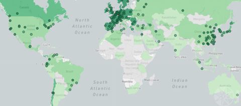
Rapid Transit Database itdp.org
Collection of all rapid transit corridors worldwide, including bus rapid transit, light rail, and subway, published by the Institute for Transportation & Development Policy.
-
MetroExtracts interline.io
Each day, OSM Extracts by Interline mirrors the entire OpenStreetMap planet and creates city and region sized extracts ready for download into formats ready for GIS.
-
IPCC Atlas interactive-atlas.ipcc.ch
A novel tools & data for flexible spatial and temporal analyses of much of the observed and projected climate change information underpinning the Working Group I contribution to the Sixth Assessment Report, including regional synthesis for Climatic Impact-Drivers (CIDs).
-
Inrix inrix.com
Delivers innovative data products for the automotive and transportation industries such as real-time parking and traffic information solutions.
-
InCitu incitu.us
An AR platform designed to support urban planners in the analysis and visualization of urban data by representing scale models of buildings, affordable housing, mixed-use development, parks, and bridges.
-
LEARN icleiusa.org
This interactive web mapping tool was developed to help communities in the USA estimate the local greenhouse gas (GHG) impacts of their forests and trees.
-
Location Affordability Index hudgis-hud.opendata.arcgis.com
The Location Affordability Index (LAI) works to close this gap by providing estimates of household housing and transportation costs at the neighborhood level along with constituent data on the built environment and demographics.
-
Temperature Severity Indicators hudgis-hud.opendata.arcgis.com
The Temperature Severity Indicator data distills observational information of prolonged temperature events to inform housing and community development policy and decision making provided by US HUD.
-
H+T Index htaindex.cnt.org
The Housing and Transportation (H+T®) Affordability Index provides a comprehensive view of affordability that includes both the cost of housing and the cost of transportation at the neighborhood level. Provided by the Center for Neighborhood Technology.
-
Humanitarian OpenStreetMap Tools & Data hotosm.org
HOT provides a rich set of tools for the OSM community. An especially helpful tool is the Export Tool.
- next page of items loading…