Miscellaneous
17,439 items in 132 lists
-
EarthDefine earthdefine.com
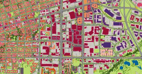
Using AI to transform earth sensor data into consumable geospatial information products including high resolution land cover classifications and building footprints.
-
Extreme Heat Data Pathfinder earthdata.nasa.gov
A central repository hosting multiple datasets guiding users to relevant near-real-time data for extreme heat analysis and visualization based on NASA's remotely sensed data.
-
Mapping Inequality dsl.richmond.edu
An interactive map that layers georectified Home Owners' Loan Corporation (HOLC) maps onto a modern basemap of the United States. These color-coded HOLC maps were a physical embodiment of the real estate practice known as redlining. Additional Information: License: CC BY-NC-SA…
-
Geofabrik download.geofabrik.de
OpenStreetMap extracts prepared in either PBF or shapefile format for download daily.
-
BBBike download.bbbike.org
Provides shapefiles and raw OSM format for cities around the world, extracted weekly. This is useful if you are looking for data extracts for a single city.
-
GATIS dotbts.github.io
A data specification for active transportation infrastructure that is supported by the National Collaboration on Bicycle, Pedestrian, and Accessibility Infrastructure Data (NC-BPAID).
-
vLLM docs.vllm.ai
A high-throughput and memory-efficient inference and serving engine for LLMs.
-
Momepy docs.momepy.org
A library for quantitative analysis of urban form - urban morphometrics. It is part of PySAL (Python Spatial Analysis Library) and is built on top of GeoPandas, other PySAL modules and networkX.
-
ClimRR disgeoportal.egs.anl.gov
This portal empowers individuals, governments, and organizations to examine simulated future climate conditions at mid- and end-of-century for a range of climate perils.
-
Digital.Gov digital.gov
Guidance and resources on building better digital services in government.
-
Digiplan digeplan.com
Provides software for fully integrated electronic plan review and intake processes.
-
Strava developers.strava.com
API for a popular tracking app for runners and cyclists. Data can be used to understand active transportation usage and patterns.
-
GTFS-RT developers.google.com
This standard provides users transit data updates in real time greatly enhances their experience of transit services.
-
http://www.unifont.org/fontguide/ unifont.org
-
Version 4.0.0 unicode.org
-
Version 9.0.0 unicode.org
(Latest Version, August 2016 - adds exactly 7,500 characters)
-
Version 7.0.0 unicode.org
-
Version 6.3.0 unicode.org
-
Version 6.2.0 unicode.org
-
Version 6.1.0 unicode.org
-
Version 6.0.0 unicode.org
-
Version 5.2.0 unicode.org
-
Version 5.1.0 unicode.org
-
Version 4.0.1 unicode.org
-
Unicode Character Database unicode.org
-
http://www.unicode.org/roadmaps/ unicode.org
-
-
Unicode FAQ unicode.org
-
Unicode Consortium's Emoji Chart unicode.org
-
Confusable Unicode Characters unicode.org
-
Unicode Normalization Chart unicode.org
-
Unicode Character Code Charts unicode.org
-
Unicode Case Charts unicode.org
-
Unicode Blocks List unicode.org
-
Space Yourself smashingmagazine.com
Smashing Magazine's Spacing Guide
-
Shapecatcher shapecatcher.com
Draw the character you're looking for.
-
How to register an emoji URL name.com
-
JavaScript has a Unicode Problem mathiasbynens.be
-
Creative usernames and Spotify account hijacking labs.spotify.com
-
-
The Absolute Minimum Every Software Developer Absolutely, Positively Must Know About Unicode and Character Sets joelonsoftware.com
By Joel Spolsky
-
https://en.wikipedia.org/wiki/Unicode_font#List_of_Unicode_fonts en.wikipedia.org
-
emojitracker emojitracker.com
Realtime emoji use on Twitter.
-
Emojipedia emojipedia.org
Information about specific emoji, news blog.
-
World Translation Foundation emojifoundation.com
A way to promote, explore, and translate the written word into the pictorial alphabet of Emoji.
-
Database Dumps of Codepoints.net dumps.codepoints.net
-
Can I Emoji? caniemoji.com
Displays the current status of native Emoji support across iOS, Android and Windows.
-
ArcGIS Python API developers.arcgis.com
The ArcGIS API for Python is a powerful, modern and easy to use Pythonic library to perform GIS visualization and analysis, spatial data management and GIS system administration tasks that can run both interactively, and using scripts. This library enables easy use of Pandas…
-
Urban Heat Disparities Project dataverse.harvard.edu
Census Tract level temperature data derived from a paper use remotely sensed land surface temperature measurements to explore the distribution of the United States urban heating burden by demographic group.
-
Harvard Dataverse dataverse.harvard.edu
A repository for research data. It contains a wide variety of datasets spanning the sciences, many with public domain dedications.
- next page of items loading…