Miscellaneous
17,439 items in 132 lists
-
Data Standards Directory datastandards.directory
This open directory of data standards aggregates known data standard examples and features a taxonomy on how to understand their application.
-
Data Center Policy Database datacenterpolicy.com
A searchable database of data center policies, useful for planners navigating the land rezoning, water and energy demands, and transparency issues that accompany data center siting in their jurisdictions.
-
GTNS zephyrtransport.org
General Travel Network Specification: A planned data specification for sharing travel demand model networks.
-
YourStop yourstop.info
Mobile friendly web app which consumes GTFS feeds and displays both live and scheduled trips for stops. Launched with MBTA, YRT/Viva and Maryland MTA.
-
Yandex Maps - Transport integration yandex.ru
Additional Yandex-specific documentation of GTFS.
-
Rail Transit Maps www-personal.umich.edu
A collection of railway maps covering Europe (especially Russia).
-
Rail Map Generators wongchito.github.io
Tool for generating railway maps and information panels in the styles of various cities' public transportation systems.
-
WMATA Exit Optimizer wmata-exit-optimizer.com
Suggests which train car to board for the shortest walk to your destination station's exit on the WMATA Metro.
-
OSM Relatify wiki.openstreetmap.org
OSM Relatify is a tool that simplifies the process of maintaining public transport relations.
-
PTNA wiki.openstreetmap.org
Public Transit Nework Analysis is a open source system for finding and aggregating information about public transportation lines mapped in OSM.
-
OsmAnd wiki.openstreetmap.org
OsmAnd is a GPS Navigation and map application that runs on many Android and iOS smartphones and tablets, featuring optional offline maps and turn by...
-
Openptmap wiki.openstreetmap.org
openptmap shows public transport lines.
-
OpenStop wiki.openstreetmap.org
OpenStop is a free app to add information about barriers and other accessibility properties of public transport stops to OpenStreetMap.
-
OSMTracker wiki.openstreetmap.org
OSMTracker is an offline GPS tracking app designed for collecting Points of Interest (POIs) and recording GPX tracks for collaborative use.
-
JOSM Plugins - PT Assistant wiki.openstreetmap.org
The plugin validates public transport routes against a set of criteria and, where possible, suggests ways to fix them.
-
AccraMobile3 wiki.openstreetmap.org
Accra Mobile 3 is a project launched in July 2017 to map all the Tro tro lines of Accra, Ghana for the Department of Transport (DoT) of Accra...
-
UrbanRail.Net urbanrail.net
Worldwide reference map of urban rail transport (metros,trams,commuter rail) with detailed and up-to-date information.
-
Ualabee ualabee.com
Community driven trip planner with focus on user interaction, users can report anomalies, upload pictures, edit transit data and chat with other passengers.
-
MTA Frequency tyleragreen.com
Frequency visualization of subways and buses in New York City built using Transitland.
-
TripGo tripgo.com
-
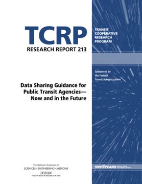
TCRP Research Report 213: Data Sharing Guidance for Public Transit Agencies – Now and in the Future trb.org
(2020) - A report designed to help agencies make decisions about sharing their data, including how to evaluate benefits, costs, and risks.
-
Traze traze.app
by Veridict - Visualization of public transport vehicles from all over the world. Collaborate with other users to get real-time updates even when it is not available from the agency. Based on a number of sources, including GTFS and GTFS-RT. (Previously known as Livemap24).
-
TransSee transsee.ca
Real-time transit predictions based on actual travel times, vehicle locations, schedules and maps. Premium gives you access to a detailed history of schedules, vehicle locations, stop arrivals, schedule adherance, charts and graphs. For an additional fee custom queries can be…
-
Transport API transportapi.com
REST API for aggregated transit data for the United Kingdom. Fee-based access.
-
GTFS Diff transport.data.gouv.fr
GTFS Diff is a specification created by transport.data.gouv.fr and aims at providing a simple and unified way to express differences between GTFS files.
-
transport.data.gouv (France) transport.data.gouv.fr
Data platform for the French transport ecosystem.
-
Transit Tracker transittracker.ca
Realtime vehicle position for Greater Montreal & Toronto, Canada
-
Transit Techies NYC transittechies.nyc
NYC-based in-person/online hybrid meetup. Speaker list includes many contributors to this repo.
-
TransitScreen transitscreen.com
Custom realtime displays of all local transportation choices
-
Transitous transitous.org
Community-run free and open public transport routing service.
-
Transit Maps transitmap.net
Critiques and reviews of the design of transit maps from across the world.
-
Transit Display transitdisplay.com
Multimodal and real-time transit display software.
-
Open Transit Data Toolkit transitdatatoolkit.com
A series of lessons to help people utilize open transit data.
-
"AVL, CAD, and Real-Time Passenger Info for Beginners" by Tony Laidig transitdata.net
Provides a general introduction to technology used to track vehicles.
-
TransitData.io transitdata.io
A list of GTFS data in parts of Latin America. Must contact website maintainers directly to access feeds, as they're not publicly available.
-
Transit transitapp.com
-
TransitLand Map transit.land
Worldwide map of transit services (which have a GTFS Feed).
-
National Transit Database (USA) transit.dot.gov
Information and statistics on the transit systems of the United States, run by the Federal Transit Administration.
-
Simple Transit Site transit.chat
An online example of how to create a transit website all from your gtfs on Github
-
gtfs-to-geojson transit.chat
A simple online converter for gtfs to geojson with a list of feeds.
-
TransitLens transit-lens.com
Browser-based GTFS viewer for visualizing routes, stops, and shapes on an interactive map. Includes service calendar analysis, structured data tables, and GeoJSON/KML overlay support. No setup required.
-
Transfer Hero transferhero.app
Realtime metro trip planning for WMATA that surfaces useful transfers.
-
TrainRouter trainrouter.com
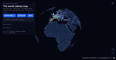
Interactive world atlas of 744 notable train routes (high-speed, scenic and night trains) with facts and photos for each route; the underlying data is open (CC BY 4.0).
-
Train Lookout trainlookout.com
A tool to easily Log, map and share your journeys by train.
-
TRAVIC Transit Visualization Client tracker.geops.ch
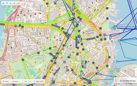
Visualizes vehicles moving based on static GTFS data (and sometimes realtime data). Supports over 260 cities. Github account for geOps organization is here.
-
Transit Explorer thetransportpolitic.com
A map containing fixed-guideway transit around the world.
-
TransitClock thetransitclock.github.io
Java application that can consume raw vehicle positions and generate prediction times in formats such as GTFS-realtime. Formerly known as "Transitime".
-
The Rail Map therailmap.com
An Interactive Map with Train lines in North America using data from OpenStreetMap.
-
Tennessine Metro Designer tennessine.co.uk
A modern and aesthetically pleasing transit map designer.
-
TBEST tbest.org
TBEST (Transit Boardings Estimation and Simulation Tool) is an effort to develop a multi-faceted GIS-based modeling, planning and analysis tool which integrates socio-economic, land use, and transit network data into a platform for scenario-based transit ridership estimation…
- next page of items loading…