Removert
Remove, then Revert: Static Point cloud Map Construction using Multiresolution Range Images.
- from
- LIDAR
- added
- 2026-10-10
- likes
- 0
similar
-
GitHub repository github.com
Remove then revert. Static map construction in the wild and dynamic points removing tool by constructing a static map.
-
-
-
Patchwork arxiv.org
Region-wise plane fitting-based robust and fast ground segmentation for 3D LiDAR data
-
traversability_mapping github.com
Takes in point cloud from a Velodyne VLP-16 Lidar and outputs a traversability map for autonomous navigation in real-time.
-
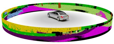
Study of LIDAR Semantic Segmentation larissa.triess.eu
Scan-based Semantic Segmentation of LiDAR Point Clouds: An Experimental Study IV 2020.


LIDAR › Algorithms > Simultaneous localization and mapping SLAM and LIDAR-based odometry and or mapping LOAM: “Remove, then Revert: Static Point cloud Map Construction using Multiresolution Range Images.”