-
OSM Landuse osmlanduse.org
OSM based landuse and landcover WebGIS application.
-
Show me the way osmlab.github.io
Live map showing latest changes on aerial imagery. (Source Code / Wiki)
-
changeset-map osmlab.github.io
Map visualizing changes in selected changesets. Used in OsmCha. (Source Code)
-
OSM History Viewer osmhv.openstreetmap.de
Changeset visualization. (Source Code)
-
OSM Go! osmgo.com
Android application and a Progressive Web Applications (PWA) for contributing to OpenStreetMap. (Android / Source Code / Wiki)
-
OSMCha API osmcha.org
Powerful API that allows to query and retrieve changeset information. (Source Code)
-
osmcha osmcha.org
Detector for suspicious changesets. (Source Code / Wiki)
-
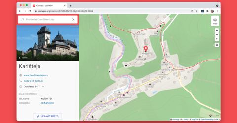
OsmAPP osmapp.org
A browsable map showing data and offering simple POI-editing capabilities. (Source Code)
-
OsmAnd osmand.net
Map viewing and navigation (routing) application with offline functionality available for Android and iOS. (Android, iOS / Source Code Android / Source Code iOS / Wiki)
-
OSM2World osm2world.org
converter that creates three-dimensional models of the world from OpenStreetMap data. It can be used as a stand-alone tool, on a server or as a library in Java programs. (Source Code / Wiki)
-
osm.mazdermind osm.mazdermind.de
Maps Timestamp to replicate sequences. (Source Code)
-
Bellingcat OpenStreetMap search osm-search.bellingcat.com
Web based tool to find geolocation leads by searching for proximate features on OpenStreetMap. (Source Code / Article)
-
OSM Monitor osm-monitor.com
A website to monitor and display new OSM edits. (Source Code)
-
OSM In Realtime osm-in-realtime.jwestman.net
Visualization of the changes made to OpenStreetMap as they happen. (Source Code / Wiki)
-
Organic Maps organicmaps.app
A free offline maps app based on OSM. (Android, iOS / Source Code / Wiki)
-
iD openstreetmap.org
JavaScript based editor for the web browser with a wide array of presets. (Source Code / Wiki)
-
OpenLevelUp! openlevelup.net
An OSM based indoor viewer.(Wiki)
-
opening_hours evaluation tool openingh.openstreetmap.de
Tool for evaluating opening_hours tags. (Source Code)
-
OpenGeofiction opengeofiction.net
A completely fictional user-made world map, created using the OSM software platform. (Wiki)
-
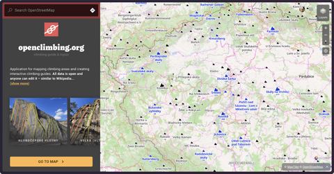
openclimbing.org openclimbing.org
A map for rock climbers with editor for creating interactive climbing guides based on OpenStreetMap.
-
OnOSM onosm.org
Allows anyone to submit business information as a note for inclusion into OSM. (Source Code / Wiki)
-
ohsome Dashboard ohsome.org
Tool for visualizing changes over a certain time period. (Wiki)
-
Nominatim QA nominatim.org
The Nominatim Data Analyser is a QA tool used to scan the nominatim database and extract suspect data from it. These data are then presented to mappers through a visual interface so that they can correct them directly.
-
NLMaps nlmaps.gorgor.de
Website allowing to query OSM data using plain English.
-
My Notes my-notes.osm-hr.org
Search for finding your old unresolved notes.
-
MapPoster Online maptoposter.0v0.one
Web-based map poster generator with customizable styles. (Source Code)
-
MapRoulette maproulette.org
Various challenges for making small edits to achive big tasks. (Source Code / Wiki)
-
MapLibre GL JS maplibre.org
A map renderer with GPU-accelerated vector tile rendering. (Source Code / See Related List)
-
Map Complete mapcomplete.osm.be
Tool for mapping in scoped tasks. (Wiki)
-
MapAtlas mapatlas.eu
REST API for geocoding, routing, isochrone, matrix, map matching, and MVT vector tiles built on OpenStreetMap data. (Docs)
-
Magic Earth magicearth.com
A free turn-by-turn navigation app. (Android, iOS / Wiki)
-
osm-livechanges live.openstreetmap.fr
Near-real-time display of edits in the OpenStreetMap database. (Source Code)
-
Level0 level0.osmz.ru
Text based editor that's useful in specific corner cases. (Source Code / Wiki)
-
LearnOSM.org learnosm.org
Extensive beginners' guide to editing OpenStreetMap. (Wiki)
-
Komoot komoot.com
A route planner and navigation app specializing in hiking and cycling. (Android, iOS / Wiki)
-
JOSM josm.openstreetmap.de
Advanced extensible desktop editor. (Source Code / Wiki)
-
indoor= indoorequal.org
Map for viewing indoor data from OpenStreetMap. (Wiki)
-
Healthsites.io healthsites.io
An online editor focused on adding and improving data on global health facilities. (Source Code / Wiki)
-
hdyc hdyc.neis-one.org
Statistics viewer for contributions of any OSM user. (Wiki)
-
GoMap!! gomaposm.com
Feature-rich mobile editor for iOS. (iOS / Source Code / Wiki)
-
openstreetmap-tag-map github.com
Tag for Riot.js to generate iframe-map from the country and region.
-
Field Papers fieldpapers.org
Generate maps for printing, annotate them, and manage your notes after. (Source Code / Wiki)
-
FacilMap facilmap.org
Map with easy possibility to filter for POI types. (Source Code / Wiki)
-
bbbike extract.bbbike.org
Custom extracts of areas from planet.osm. (Wiki)
-
Every Door every-door.app
Android and iOS app that lets you create and edit objects in OpenStreetMap. It supports editing node and polygon features, and creating point features like shops, benches, and building entrances. (Android / iOS / Source Code / Wiki)
-
NotesReview ent8r.github.io
Interface for searching and resolving OSM notes. (Source Code)
-
“OpenStreetMap World” Discord discord.gg
OSM related instant messaging and voice chat group.
-
F4map Demo demo.f4map.com
3D rendering demo of OpenStreetMap data. (Wiki)
-
Defikarte.ch defikarte.ch
A Map that shows all available defibrillators in Switzerland and Liechtenstein, also used by emergency dispatch centers and rescue services. (ℹ️ German only)
-
Damn Project damn-project.org
Project for mapping by dividing big areas into small squares mappable by humans. (Source Code / Wiki)
- next page of items loading…