-
Tune Studio studio.tune.app
Playground for software developers to finetune and deploy large language models.
-
Strong Towns Podcast strongtowns.org
The podcast explores how we can financially strengthen our cities, towns, and neighborhoods and, in the process, make them better places to live.
-
StreetSimplified streetsimplified.com
Deploys temporary cameras utilizing computer vision to examine various transportation behaviors such as speeding, crossing rule compliance, and red-light running.
-
Streetsblog streetsblog.org
Blog for news related to walking, biking, and transit.
-
Streetmix streetmix.net
A collaborative civic engagement platform for urban design. Design, remix, and share your neighborhood street with Streetmix.
-
StreetLight Data streetlightdata.com
Provides data using smartphones as sensors to measure vehicles, bikes, and pedestrians across North America. Carry out your mission on time and under budget, with 24/7 access to counts, O-D, and other metrics you need.
-
Spectracities spectracities.com
Spectra is an open source VR and mixed reality platform that allows planners and designers to combine physical placemaking and digital worldbuilding to reimagine the city making process, from single projects and infill development to large-scale immersive environments.
-
Spatial spatial.io
A highly collaborative web, mobile, and VR application planners use to create immersive co-experiences and spaces in environments including the Metaverse.
-
Space Syntax spacesyntax.net
Spatial & Network Analysis software is available to professional practitioners and academic researchers for commercial and non-commercial use.
-
Social Pinpoint socialpinpoint.com
A proprietary digital public engagement tool that allows users to give feedback and share their inspirations through interactive maps, surveys, participatory budgeting exercises, and idea wall forums.
-
SketchUp sketchup.com
Easy to use interactive 3D modeling software for planning and design applications. Supported by a rich asset library for creating neighborhood designs.
-
HouseFacts sites.google.com
The House Facts data standard is a uniform format for reporting government data on the operation, safety, and performance of residential buildings.
-
Delve sidewalklabs.com
Uses generative design and AI to reveal the very best options for your project priorities and site design metrics.
-
SharedStreets sharedstreets.io
Referencing System is a global, non-proprietary linear referencing system for describing streets maintained by SharedStreets. Additional Information: GitHub
-
Justice40 screeningtool.geoplatform.gov
The purpose of the tool is to help Federal agencies identify disadvantaged communities that are marginalized, underserved, and overburdened by pollution. Combines multiple data sources at the census tract level across eight categories of criteria.
-
EJ Screen screening-tools.com
This application uses maps and reports to present three kinds of information: Environmental indicators, demographic indicators and EJ Indexes. Additional Information: EPA took this link down in 2025, we redirect to Public Environmental Data Partners Website for the time being.
-
Screening Tools screening-tools.com
A project of Public Environmental Data Partners that is archiving and providing federal datasets related to environmental and social vulnerability screening. Datasets distributed and screening tools made available through this site include EJ Screen and CDC SVI for example.
-
Automated Decision-Making and the Law Clearinghouse Project scholarship.law.unc.edu
The aim of this clearinghouse project thus is to highlight seminal and impactful articles focused on issues of AI Decision-Making and the law.
-
ScapeToad scapetoad.choros.place
A cross-platform, open-source application designed to adjust the size of polygons based on some attribute. Use a shapefile as input and output to generate cartograms, geometries whose sizes are distorted based on data.
-
Transoft safety.transoftsolutions.com
ITS Safety solutions utilize computer vision to identify 'near-miss' behavior on streets. This technology was featured Planning Magazine in the Art of Learning by Example.
-
SafeGraph safegraph.com
Points of interest (POI) provider providing information on destination locations and their characteristics such as spending rates in the United States.
-
Repository and Open Science Access Portal (ROSA P) rosap.ntl.bts.gov
Provides access to a range of full-text current and historical documents from the National Transportation Library. Resources are available from all modes of transportation as well as related disciplines such as climate change research.
-
Rhino rhino3d.com
This is a commercial 3D computer graphics and computer-aided design application software. Rhino has had multiple plug-ins built on top of it including Grasshopper and the Urban Network Analysis toolbox to enable complex modeling and analysis.
-
Climate Mapping For Resilience and Adaptation resilience.climate.gov
Integrates information from across the federal government to help people consider their local exposure to climate-related hazards. People working in community organizations or public agencies can use the site to help them develop equitable climate resilience plans to protect…
-
Geoplot residentmario.github.io
A high-level Python geospatial plotting library. It is an extension to cartopy and Matplotlib which makes mapping easy: like Seaborn for geospatial.
-
Replica replicahq.com
A data platform providing rich origin-destination, spend, and scenario impact analysis based on an activity based modeling process.
-
Remix remix.com
A platform to empower cities to plan the best possible transportation system — from public transit to safer streets to ever-increasing new modes of mobility. Remix provides tools to edit & test GTFS, generate multimodal streets, and explore relevant data.
-
Remi remi.com
A leading provider of state, local, and national macroeconomic policy analysis models.
-
Regrid regrid.com
A leading provider of land parcels and location context data for your maps, apps and spatial analysis.
-
RAPT rapt-fema.hub.arcgis.com
The Resilience Analysis & Planning Tool (RAPT) gives everyone easy access to important community data and analysis tools related to community resilience. The community resilience indicators in the RAPT were pulled from the Community Resilience Indicator Analysis (CRIA).
-
PySAL pysal.org
The Python Spatial Analysis Library is a collection of algorithms for exploring spatial correlations and other spatial relationships.
-
TerraVide pypi.org
An open source Python package to process large urban environments mapped with LiDAR (Light Detection and Ranging) data. As of v0.1.6, focuses on tree extraction.
-
Arcpy pro.arcgis.com
A Python site package that provides a useful and productive way to perform geographic data analysis, data conversion, data management, and map automation with Python.
-
National Housing Preservation Database preservationdatabase.org
The National Housing Preservation Database contains property and subsidy-level data pulled from nine different HUD and USDA data sources. The database contains information on over 70,000 properties nationwide.
-
Polycam poly.cam
A mobile application that allows planners to scan and digitize objects and places from the real world for use in 3-D models, making photogrammetry easy with the use of their smartphone's camera.
-
PollEverywhere polleverywhere.com
Provides the ability to generate polls and questions for interactive engagement on multiple platforms.
-
Home Attainability Index policymap.com
The latest (2022) Urban Land Institute Terwilliger Center Home Attainability Index. A resource for understanding the extent to which a housing market provides a range of choices attainable to regional workforces providing insights into a wide range of factors for selected…
-
PLW Model Works plwmodelworks.com
Combines geospatial modeling expertise to create highly detailed, photo-accurate 3D polygonal city models for different industries.
-
PlanningPrep planningprep.com
A free web-based study resource to help planners prepare for the American Institute of Certified Planners' certification exam. As of summer 2021, the site contains 1668 practice questions and 12 practice exams.
-
Policy Guides planning.org
Represent APA's official position on critical planning issues and arm planners with the tools to advocate for policies that create great communities for all.
-
APA Podcast planning.org
American Planning Association's podcast with interviews and discussions on planning topics going back to 2010.
-
Planning Advisory Service (PAS) planning.org
The Planning Advisory Service (PAS) is the American Planning Association's (APA) flagship research brand which is responsible for the following publications: PAS Reports (quarterly), PAS Memo (bimonthly), and PAS QuickNotes (bimonthly). Current publications and archives of…
-
LBCS planning.org
The American Planning Association's Land Based Classification Standards classifies land uses across five dimensions (Activity, Function, Structure, Site, and Ownership).
-
APA Knowledge Base planning.org
APA's Research KnowledgeBase connects APA members to curated collections of topically related resources — including plans, regulations, model codes, guides, articles, reports, and multimedia files. Each collection provides commentary and thematic groupings of resource records…
-
AI Planning Use Cases planning.org
Is an interactive database with a map view that explores real-life applications of AI-powered technology in different planning areas across the US and globally provided by APA's Foresight group.
-
AICP Exam Prep. Webpage planning.org
Details the AICP's "Five-Step Approach" for exam preparation and lists resources/materials to help you succeed on the AICP exam.
-
AICP Get Certified! Webpage planning.org
The American Institute of Certified Planners's (AICP) offical resource repository that provides details on eligibility, registration, and preparation. Important dates for upcoming AICP "Certification Cycles" are also listed.
-
Planopedia planetizen.com
Organized by the Planning News aggregator Planetizen this mini-planning encyclopedia explores various urban planning concepts and terms.
-
Civic Tech Field Guide planetizen.com
Similar to this repo, a collection of resources of the Civic Tech Field Guide have been crowdsourced by civic tech practitioners from over 100 countries around the world.
-
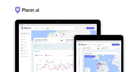
PlacerAI placer.ai
A location based data provider that provides estimates of foottraffic to different points of interest.
- next page of items loading…