-
magrit magrit.cnrs.fr
An online application for thematic mapping.
-
Global Climate Monitor kerdoc.cica.es
Global open climate data.
-
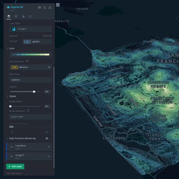
Kepler kepler.gl
A powerful open-source geospatial analysis tool for large-scale datasets.
-
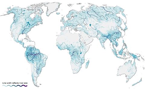
HydroSHEDS hydrosheds.org
Consistent hydrographic data for global applications.
-
ArcGIS Hub hub.arcgis.com
Over 380,000 open datasets.
-
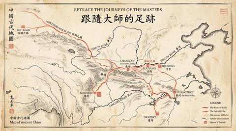
China Culture Literati Journeys history.walkingchina.com
Interactive historical GIS and spatio-temporal storytelling map tracing the lifetime journeys and exile routes of classical Chinese thinkers.
-
GraphHopper Route Optimization API graphhopper.com
Solves various vehicle routing problems.
-
Chroma.js Color Palette Helper gka.github.io
Chroma.js-powered tool for mastering multi-hued, multi-stop color scales.
-
IMAGE gisco-services.ec.europa.eu
Tool for generating thematic maps.
-
GISCO data distribution API gisco-services.ec.europa.eu
European Commission data source for administrative regions and boundaries.
-
Address API gisco-services.ec.europa.eu
Pan-European address data with geocoding and reverse-geocoding.
-
Open Postcode Geo API getthedata.com
British postcodes with geospatial data.
-
bng2latlong getthedata.com
Converts British National Grid to latitude and longitude.
-
Geospatial Network Visualization geonetworks.github.io
A collection of visualization techniques for geospatial network data.
-
geonames geonames.org
Supports placename lookup and reverse geocoding.
-
OpenStreetMap geofabrik.de
Free, world-wide geographic data set.
-
Geocode.xyz geocode.xyz
Reverse geocoding, forward geocoding, and geoparsing API.
-
Geoboundaries geoboundaries.org
The world's largest open, free political boundaries database.
-
API Geo geo.api.gouv.fr
Official French geographical data API.
-
Galileo galileo.gisdata.io
Geospatial data discovery and management platform.
-
Free GIS data freegisdata.rtwilson.com
Links to over 500 sites providing freely available geographic datasets.
-
Forest Fires Map forest-fires-map.vercel.app
Interactive web map of forest fires.
-
Material Symbols fonts.google.com
Over 2,990 glyphs in a single font file with a wide range of design variants.
-
Europe Beach Map europebeachmap.com
Every notable European beach on one map, with sea temperature, sand and best season for each.
-
Thematic Mapping: 101 Inspiring Ways to Visualise Empirical Data esri.com
Kenneth Field.
-
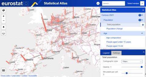
Statistical Atlas ec.europa.eu
A leaflet-powered atlas showcasing Eurostat's statistics.
-
European population grids - GISCO ec.europa.eu
Population figures in grid cells.
-
Copernicus global DEM ec.europa.eu
Global elevation tiles.
-
Healthcare Services in Europe ec.europa.eu
Locations of healthcare services in Europe.
-
European Postcodes Point Data ec.europa.eu
Location of postal codes across Europe.
-
USGS earthquake data earthquake.usgs.gov
Search earthquake data by various parameters.
-
USGS Earth Explorer earthexplorer.usgs.gov
Query and order satellite images and more.
-
breezometer docs.breezometer.com
Air Quality, Weather, Pollen, and Environmental data.
-
Google Maps developers.google.com
JavaScript API for Google Maps.
-
Google Earth Engine developers.google.com
Geospatial processing service.
-
ArcGIS location services developers.arcgis.com
Basemaps, Geocoding, Places, routing, and GeoEnrichment.
-
what3words developer.what3words.com
Converts 3-word addresses to coordinates.
-
TomTom developer.tomtom.com
Geocoding, routing, traffic, and more.
-
HERE maps API developer.here.com
Build web applications with feature-rich and customizable HERE maps.
-
Detourmap detourmap.com
Waterfalls, caves, volcanoes and lonely coasts, plus the ruins, tombs, ghost towns and shipwrecks people left behind, on one world map, built from Wikidata.
-
Global power plant database datasets.wri.org
Open source database of power plants.
-
WRI datasets.wri.org
World Resources Institute.
-
Country State City API countrystatecity.in
Database of city, state, and country data.
-
Copernicus open access hub copernicus.eu
Copernicus satellite imagery download.
-
Color use guidelines for mapping and visualization colorbrewer2.org
Cynthia A. Brewer.
-
ClimateArchive climatearchive.org
An interactive visualisation of climate model data across time and space.
-
Fundamentals of Data Visualization clauswilke.com
Claus O. Wilke.
-
chronotrains chronotrains.com
Where can you go by train in 8h?
-
geotiff.io app.geotiff.io
Provides quick access to easy-to-use raster processing.
-
Geoapify map marker playground apidocs.geoapify.com
The Marker Icon API lets you create beautiful icons and use them as Map Markers.
- next page of items loading…